

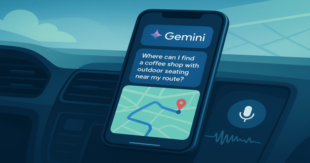
In November 2025, Google announced a transformative update to Google Maps: it has been augmented with Gemini AI to become a conversational, hands-free navigation assistant, grounded in real-world geospatial data and designed to transform how users move, explore, and interact with places. Moneycontrol+3The Verge+3AP News+3 Because Maps already serves billions of users globally, this shift signals a major evolution in navigation apps — from static turn-by-turn directions toward intelligent agents that reason about context, environment and intent.
In this insight we’ll explore: what was released; how the technology works; implications for developers and product teams; technical integration examples; risks and moderation considerations; and finally, strategic takeaways for the future of location-aware AI apps.
1. What Was Announced & Why It Matters
The key announcement by Google reveals several noteworthy new capabilities in the Google Maps + Gemini integration:
- Users can ask natural-language questions during navigation. For example: “Find a vegan restaurant with outdoor seating 2 miles ahead on this route”, and then simply say, “Okay — add that stop.” blog.google+1
- The system uses landmark-based directions, not just distances. For example: “Turn right after the Thai Siam Restaurant”. It does so by cross-referencing Street View imagery and the 250 million+ places index in Maps. blog.google+1
- Proactive traffic alerts are being introduced: even when a user is not actively navigating, the AI monitors your route and can alert you of disruptions (accidents, closures, heavy traffic) in time to reroute. The Verge+1
- For developers, Google launched the Grounding with Google Maps tool in the Gemini API, allowing location-aware responses grounded in Maps data — enabling apps beyond just Google’s own Maps to leverage this integration. blog.google+1
These announcements matter because they represent a paradigm shift: navigation apps are no longer just “give me directions” tools—they are active co-pilots that reason, plan, adjust and assist. For app builders, the inclusion of this kind of AI within a geo-spatially-rich context introduces new UX, data and monetization opportunities — and new complexity.
2. How It Works under the Hood
To understand the full magnitude of this update, let’s unpack the technical underpinnings and architecture involved — at a high level.
2.1 Data Grounding & Real-world Context
One of the core challenges for conversational AI is avoiding hallucinations — especially when recommending locations, routes or businesses. Google addresses this by coupling Gemini’s reasoning model with Maps’ factual geodata. In short:
- The “Grounding with Google Maps” tool within the Gemini API allows developers to pass location context (latitude/longitude, place IDs) and receive responses that cite verified Places, user reviews, addresses, and opening hours. Google AI for Developers
- The API returns metadata such as
groundingChunks(source URIs, place IDs, titles) andgoogleMapsWidgetContextTokenwhich a UI can use to render an interactive Places widget. Google AI for Developers+1 - For example, a prompt like:
prompt = "What's a good coffee shop within a 15-minute walk from here?"with tools:googleMaps = types.GoogleMaps()
leads to retrieval of nearby places, review summaries, and a grounded answer. Google AI for Developers
2.2 Conversational & Hands-Free Navigation
Within the Maps app, the integration manifests as:
- The microphone / voice-query system now triggers Gemini rather than the older Google Assistant in some flows. Android Central
- Users may issue multi-step commands, and the system may keep context across follow-up queries: e.g., “Find parking near my destination. Now remind me where I parked when I arrive.” blog.google
- Real-time vehicle context is leveraged: for example if driving, the UI switches to a minimal / voice mode, and landmark-based guidance is emphasized. Maps utilizes Street View, landmark indices and live traffic to provide instructions like: “Turn left at the big red mural, then after 300 m merge right at the gas station sign.” The Verge+1
2.3 API-Level Example
Here is a conceptual code snippet illustrating how a developer might call the Gemini API with maps grounding — simplified for illustration:
|
1 2 3 4 5 6 7 8 9 10 11 12 13 14 15 16 17 18 19 20 21 22 23 |
import requests API_KEY = “YOUR_GEMINI_API_KEY” ENDPOINT = “https://api.google.com/genai/v1/generate_content” payload = { “model”: “gemini-2.5-pro”, “contents”: [ {“text”: “Suggest a vegan restaurant with outdoor seating along my route in San Francisco.”} ], “tool_config”: { “googleMaps”: { “enableWidget”: True, “location”: {“lat”: 37.7749, “lng”: –122.4194} } } } headers = {“Authorization”: f“Bearer {API_KEY}”, “Content-Type”: “application/json”} response = requests.post(ENDPOINT, json=payload, headers=headers) response.raise_for_status() data = response.json() print(data[“candidate_responses”][0][“text”]) # Then optionally render widget from data[“googleMapsWidgetContextToken”] |
(For full reference, see Google’s official docs.) Google AI for Developers+1
2.4 Integration with UX & Vehicle Mode
- In driving mode, Maps may switch UI to a low-distraction format, combined with voice prompts.
- Gemini replies may be read aloud, and if a user asks follow-up, the system retains context.
- Landmark-based routing ensures the driver sees visually meaningful cues rather than raw distances (easier while driving).
- Backend architecture likely involves streaming telemetry (vehicle vs pedestrian mode), context-aware state management and live retrieval of place/traffic data.
3. Implications for Developers & Product Teams
Because this update is substantial, several strategic implications for builders and product teams emerge:
3.1 New Expectations from Users
- Conversation > Command: Users will increasingly expect to speak naturally rather than execute rigid voice commands (e.g., “Find cheapest EV charger between here and Seattle”).
- Context-awareness: Apps must consider time, route, vehicle/pedestrian mode, personal calendar, preferences.
- Grounded information: Users will demand accuracy, freshness and sources (especially for location apps). Hallucinations will be less tolerated.
3.2 Developer Surface & Monetization
- With the Gemini Maps grounding tool now publicly available, third-party apps (travel, real estate, delivery, mobility) can integrate location-aware AI experiences. blog.google+1
- Monetisation opportunities include premium features (e.g., Gemini-powered concierge stops, subscription for proactive route suggestions), partnerships (restaurants, EV networks) and location-based commerce.
- Developers must plan for costs because grounding with Maps may include usage costs and rate limits. Google AI for Developers
3.3 UX & Safety Considerations
- Driving safety: UI/voice must minimise distraction; voice should dominate, visuals limited while in motion.
- Source transparency: When giving recommendations (“This cafe has 4.7★ from 1.2k reviews”), the source must be clear.
- Fallback strategies: If model confidence is low, prompt user for clarification (“Do you mean the coffee shop near Market St or Union Square?”).
- Localization & accessibility: Landmark-based instructions favour familiar cues; apps must tailor to local landmarks, languages and driving norms.
- Privacy controls: When using calendars, travel history, or personal preferences, explicit consent and clear opt-outs must be provided.
3.4 Competitive Landscape & Differentiation
- Because Google Maps elevates the baseline for navigation experience, competing apps (Waze, Apple Maps, etc.) will respond. Developers in adjacent verticals (mobility, travel planning, logistics) must consider how to integrate similar conversational/grounded AI.
- Differentiation may come from niche focuses (e.g., off-road navigation, ethnic cuisine stops, EV network planning) or domain-specific enhancements (field-service, logistics fleets, tourist experiences) rather than general navigation.
4. Risks & Limitations
While the update is promising, it is not without risk:
- Hallucination risk remains: Although grounded, if data is stale (reviews outdated, business closed) recommendations may be incorrect. Google acknowledges this. The Verge
- Geo-privacy concerns: Consistent tracking of route, preferences and stops could lead to user discomfort unless clearly managed.
- Compute & latency: Real-time voice + location + retrieval + model response may tax backend; latency can degrade driving safety.
- Feature fragmentation: New capabilities may roll out gradually (US first, Android first, etc.), causing inconsistent experience. Cinco Días
- Monetisation backlash: Users dislike pay-walls for core navigation features; apps must balance free value vs premium add-ons carefully.
5. Strategic Roadmap for Teams & Startups
Here is a suggested roadmap for teams who want to act on these developments:
Prototype “conversational map assistant”:
- Build a voice query interface that can answer simple queries (“Coffee shop near me”, “Avoid tolls”, “What’s parking like?”).
- Integrate Grounding with Google Maps tool to fetch and ground responses.
- Minimise UI to voice mode for safe driving or walking.
- Implement fallback UI for manual interaction.
Contextual Route Planning & Suggestions:
- Extend to multi-step tasks: route planning with stops, time quotas, vehicle type (EV).
- Integrate personal data (calendar, preferences) with user consent to personalize suggestions.
- Add proactive alerts (traffic disruption, charging station availability, parking).
- Measure latency, NPS, user trust metrics.
Monetisation & Partnerships:
- Introduce premium features: curated route suggestions, dynamic pricing on stops, branded partnerships.
- Offer SDK/integration to businesses (tourist apps, logistics fleets).
- Ensure data ethics and compliance: global rollout includes region specific privacy laws (GDPR, CCPA, etc.).
Scale & Differentiation:
- Expand to non-driving modes: walking, cycling, public transit — each with unique context cues.
- Add AR or mixed-mode UI (e.g., landmark-overlay visuals for pedestrians).
- Localise deeply: custom landmarks, dialects, infrastructure in emerging markets.
- Continuously monitor for hallucinations, feedback loops, and model drift.
6. Key Takeaways
- Google Maps’ integration of Gemini converts a static navigation tool into a conversational, grounded assistant capable of multi-step route suggestions, landmark-based directions and proactive alerts.
- For developers and product teams: blending multimodal AI + geospatial grounding + voice/hand-free UX is rapidly becoming a baseline expectation for navigation and location apps.
- Building value today means focusing on safe voice UX, accurate place grounding, useful personalization, and contextual automation.
- The API surface (Gemini + Maps grounding) is now available to third-parties — offering opportunities for niche apps (EV routing, logistics, local discovery) to build on top of this foundation.
- Privacy, latency, trust and data quality are critical constraints — overlooking them can erode user adoption quickly.
FAQ
Google indicates rollout starts in the U.S. on Android and iOS, with vehicle integrations (Android Auto) coming later. blog.google
Yes. The Gemini API’s Grounding with Google Maps tool is publicly available for developers, enabling similar location-aware conversational experiences. Google AI for Developers+1
Not immediately. Some actions may still invoke Assistant. However, Google is shifting toward using Gemini as the core conversational engine in Maps. Android Central
Focus on niche uses (e.g., eco-friendly routing for EVs, field service context, tourist-specific experiences), build strong trust/verification frameworks, and personalize deeply for specific user segments rather than trying to match the broad generality of Maps.
Conclusion
The update to Google Maps with Gemini AI is more than a feature bump — it marks the emergence of navigation-as-an-assistant, where context, voice, grounding and proactivity define user expectations. As voice interfaces, multimodal reasoning and live geospatial data converge, product teams building in mobility, travel, logistics or location discovery will need to evolve their UX, data stack and AI strategy accordingly. The future of maps is not just “get from A to B” — it’s “help me get from A to B, plus discover, detour, plan and personalise it for me.”






Leave a Reply